
LlamaZOO’s TimberOps software will support Mowachaht/Muchalaht, the first-ever First Nation to use the technology for improving land management & stewardship.
Read Press Release Here.
Really excited to share that we have signed an agreement with Mowachaht/Muchalaht First Nation, enabling them as the first-ever First Nation to use digital twinning software technology for improving land management and stewardship. Leveraging our TimberOps software, Mowachaht/Muchalaht will use a digital twin of the nation’s 350,000+ hectares of territory (land and water) on Vancouver Island to facilitate meaningful reconciliation through shared decision-making as well as provide greater certainty for responsible development proposals of the land with industry (forestry and mining), and government.
“A digital twin of land data through TimberOps enables authorized users to virtually experience all aspects of the land, at any vantage point, from their office or home, limiting the need for field visits.”
Charles Lavigne LlamaZOO CEO and Co-Founder
“It will be transformative for First Nations, governments and industry in reaching agreements about land use stewardship, co-management and decision-making for responsible resource development because it enables information continuity between all parties, particularly in a post-COVID world where travel and face-to-face interactions are restricted,” said Charles Lavigne, LlamaZOO CEO and Co-Founder.
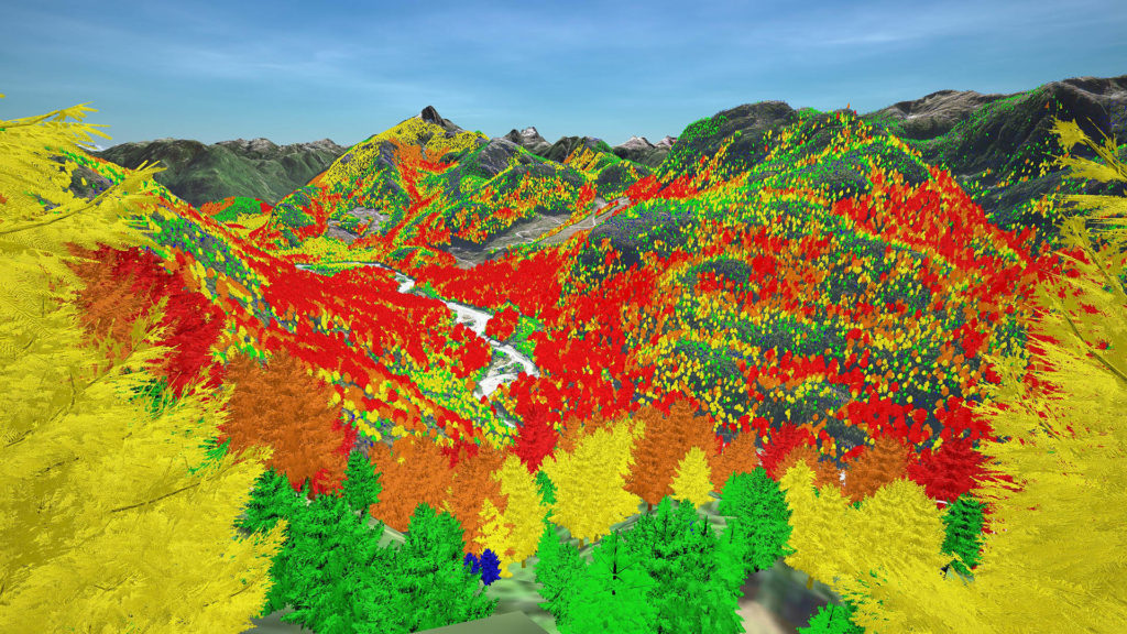
With the most data layers ever seen in a digital twin at LlamaZOO and over 100 years of historical BC logging data, the technology will replace previously used tools such as Google Earth and physical maps, and turn large amounts of complex landscape-level data into an intuitive, 3D digital twin. Mowachaht/Muchalaht will use the materials that are stored in their Cultural Resource Center; such as the recorded Culturally Modified Trees, places of sacred significance, named Places, places to gather food/seafood and other cultural information to complement the new technology.
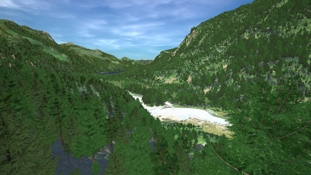
LlamaZOO leverages it’s decades of experience with spatial data and Mixed Reality to create tools which combine big data, data analysis and real-time visualization to solve real-world problems. TimberOps fuses complex landscape level geospatial, and satellite data, with planning and analysis tools into an interactive true to scale digital twin of the planned, current, and future states of the environment.
“This technology will assist our people in showing the world what is within our Traditional Territory. It will provide prospective business partners and forestry companies with a real-time view of the results of logging, mining and other resource extraction. TimberOps is going to play a critical role in how we manage our lands and resources.” said Chief Maquinna, Mowachaht/Muchalaht First Nation.
TimberOps helps all users to:
- Design accurate cutblocks and roads in-office and improve planning accuracy.
- Reduce field planning trips and travel costs as well as improve safety.
- Meet multi-objective land management goals involving watersheds, wildlife habitat and visual quality objectives (VQO).
- Facilitate stakeholder and community consultations with intuitive topographic visualizations and remote connectivity.
- Reduce onboarding and training time while improving quality assurance.
To learn more about LlamaZOO and TimberOps visit: LlamaZOO.com/timberops


